Mountain Biking In Creel, Mexcio
It was late September in Mexico’s Sierra Madre. The wind was calm and the sun just cresting the lip of the canyon wall. I sit on a mountain bike; mud slung from seat to spoke. As my heart begins to fill with adrenaline, my mind begins to question. Should I really be doing this alone?
Creel is a tourist town high in the Sierra Madre that was originally a Rarámui Indian village (Tarahumara as they now like to be called). Creel grew to be what it is today because of the Chihuahua al Pacifico (El Chepe) train station. It was the last stop in the Sierra Madre.
Its streets are lined with crafts and artwork, with sales directly benefiting the community. The food is deliciously authentic, and the children are of course more than happy to show you around town for about ten pesos.
Keep reading; there is a cool little video of me mountain biking below.
Getting To Creel
There are two ways into Creel Mexico. One from the North the other from the South. The former being the cheapest as well as easiest option. Flying into Chihuahua city, then taking a $10.62 USD, four-hour bus ride on Noroeste bus lines South-West across the country.
Coming from the South means only one option, and that is the El Chepe. The El Chepe is the last passenger train in Mexico and travels between Los Mochis and Chihuahua City and vice versa. There are no roads that can transport you all the way through the Barrancas Del Cobre (canyon of Copper). Even the local canyon residents have to pay to get to and from home. Let me hear you say that ain’t right!

The Valley of Mushrooms and Frogs
Rent and Ride
A trip to Creel is not complete until you go into the wilderness and explore the gorgeous countryside. You can go hiking, mountain biking or ride an ATV. I recommend renting a mountain bike from “The 3 Amigos Adventures”. It costs only 350 pesos for an entire day, and it allows you to ride up to the locals homes without having an obnoxiously loud ATV. You can even split the trails into two days of fun like I did.
In my experience, late September is the best time to go into the Sierra Madre. The rainy season ends earlier in the month which means perfect mountain biking weather and the yellow flowers dancing in the wind above the bright green grass are mesmerizing.
Caution! The elevation is around 7,500 ft above sea level, which may seem like nothing to mountain folk, but it made this Kansas boy a little light headed. It might be a good idea to give it a day to acclimate.

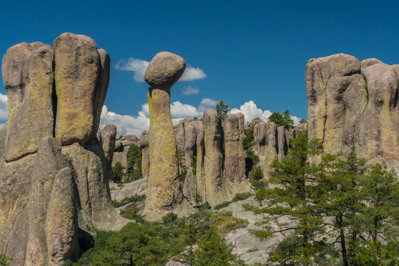
The Valley of The Monks
There are three main trails leading out to Creel’s natural attractions. One takes you east past San Ignacio Mission, that was built in the 1st part of the 18th century, then through the valley of mushrooms and frogs to Valle de Los monjes (valley of the monks). There is a toll booth at the beginning of the trail that will cost you a whopping 25 pesos.
The second and third lead you into Tararecua Canyon to Rukiraso Falls and Recowata hot springs, which I will touch on shortly.

Amazing Rock Formations
The valley of the Monks was formed millions of years ago by volcanic activity. Time and weather have slowly withered the pillars down to what they are today. They are referred to as monks due to the cloaked humanistic silhouette of some of the rocks. The area is renowned for rock climbing as well as mountain biking.
Once you’ve had your fill of the valley of the Monks, you can head back south toward Lake Arareko. Once a swamp, Lake Arareko was flooded to supply water to Creel but never saw its purpose realized, so it just sits there looking pretty. I was going to take a photo, but I got bombarded by a heard of children wanting to play with my camera.
From Lake Arareko you can hop on the main road and take it into town or stop off on the second and third trailheads I previously mentioned.

Mochogueachi Valley
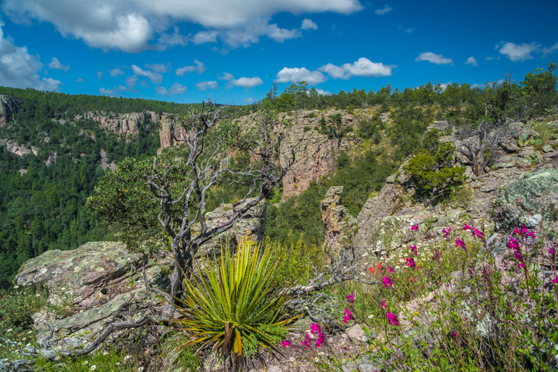
Trailhead numero dose takes you down through Mochogueachi Valley (valley of the heads), along the San Ignacio river, then up through Tararecua canyon to stunning views atop the canyon walls. Mexico’s highest year-round waterfall at 65.6 feet, although barely visible can be seen from above.

Tararecua Canyon

Canyon Ridge

Living On The Edge
Ready. Set. Go!!
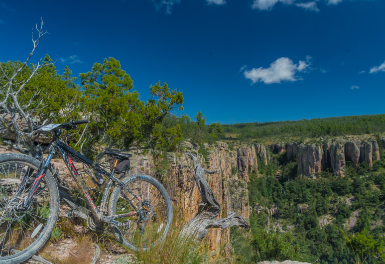
Every once and awhile. Well, ok pretty much all the time, I like testing my limits and throwing myself head first out of my comfort zone. September 23, 2016, was no exception. I sat atop a mountain bike amidst a stunning canyon gorge and thought to myself, why not ride the wheels off this thing? Why not go as fast as I can down the sketchiest path I’ve seen in Mexico so far?

Down By The River
For those asking “hey man, what about the third trail?”. Well, I planned to go back the next day and sit in the hot springs to soothe my soul for a while. My wallet, as well as my ass, had had enough for one trip to Creel Mexico. So I watched an adventure movie in my room to make up for it. It is on my list for next time.
Thanks for Reading!
Have you been to the hot springs in Creel Mexico?
If so, leave a comment and tell me all about what I missed out on.


Loved the video! What a beautiful place.
Thanks, Amy! It was a pretty fun experience.
This looks like a blast! How many days do you think it would take to get the full copper canyon experience!?
I was there for 3 days and only saw the very edge of the canyon. They have an entire adventure park further into the canyon. I would say just a little over a week to fly, and bus in and have some time to see everything.
Jump on your mountain bike and cycle past unique rock formations, waterfalls, pueblos and cave dwellings.
Thanks a bunch for sharing this with all of us you really understand what you are speaking about!
Bookmarked. Kindly additionally visit my site
=). We can have a link exchange arrangement between us